| 519 | West Prussia: Index to areas, Part-1 |
|
| 520 | West Prussia: Index to areas, Part-2 |
|
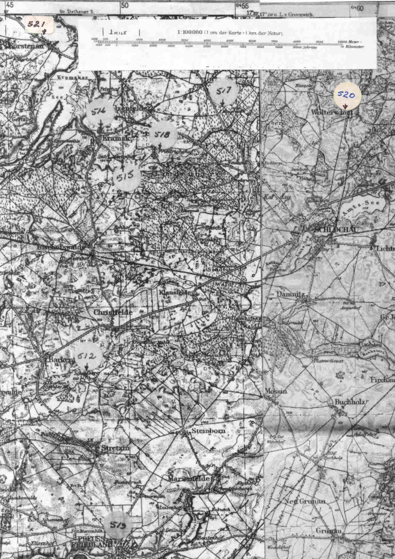
| 521 | Map, Part-1 mainly of West Prussia NOTE:: The YELLOW arrow points to Kreis Schlochau |
|
| 522 | Map, Part-2 mainly of East Prussia |
|
| 523 | Map: Pomerania, showing location of Schlochau (Yellow Arrow) Branch-1F (Red Arrow) |
|
| 524 | Map: Detail of Kr. Schlochau and yellow area where Branch-One
Krause were located. Friedrichshof: Family of Johann/John Krause; Mauersin: Herman Krause |
|
| 524a | Schlochau-Branches Krause (see code on map) [NOTE:
the designation of Br-01x where x indicates the different branches
found by Y-Chromosome DNA testing] 512 Schildberg, 513 Richenwalde(Br-01E); 514 Elsenau(Br-01E); 515 Marienhof(Br-01E), 516 Kramsk(Br-01A); 517 Mauersin(Br-01A); 518 Friedrichshof( Br-1A) 519 Friedland, Br-01C); 520 Waltersdorf, (Br-01I) 521 Forstenan(Br-01A wife of Herman Krause) |
 |
| 524b | Same as above. Map is clearer but no scale. |
|
| 525 | Google Map of present day Poland( Previously, Kr. Neustettin, Schlochau, and Posen) Shows some of the locations as indicated in Schlochau-Branches shown above. |
|
| 526 | Kraus/Krause Surname Project: Y Results page with map of participants. |
|


