
Missouri - Geography & Maps
|
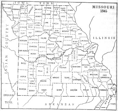
In the United States, birth, death, property, and some other kinds of records are normally kept by county governments. If you can name the place where a kin lived, new or old maps of that place may also show the county seat where useful data about your kin may be obtained. Searches for data about an ancestor are often complicated by changes in the names and boundaries of places. This automated system also contains the names of every type of feature except roads and highways. It is especially useful for genealogical research because it contains entries for very small and scattered communities as well as churches and cemeteries, including entries for those that no longer exist. Complete listings or special searches, for example, for churches in a particular county, are available in high-quality bound listings or on magnetic media. There is a nominal charge for this service. The boundaries of many political jurisdictions where early Americans lived have changed one or more times. some American families lived in the same locale for hundreds of years. Yet, the name of the place may have changed over time. Many counties have been subdivided several times, but family records were most often kept where they were originally filed. This can greatly complicate your work. In one case, for example, the place where a family lived for the entire 19th century was over time part of seven different counties. In such a case, you might have to query all seven courthouses to obtain data needed about memebers of the family. Copies of records are rarely acquired by a succeeding county. Similar, but even more complex problems arise when you must search for personal records in the archives of faraway lands. The names and boundaries of countries seem to be forever in flux and many public and private record centers disappear or move from place to place. If you know the ward, district, neighborhood, or street of a city where an ancestor lived, an old map used in conjunction with a new map of the city may expedite your search for needed facts. Books that show changes in county boundaries can help locate likely sources of records about relatives. A librarian near where you live may be able to suggest someone who has access to such sources as Map Guide to the US Federal Census, 1790-1920: Genealogical Publishing Company, Baltimore, 1988. This 445-page book shows all U.S. county boundaries from 1790 to 1920. On each of nearly 400 maps, old county lines are superimposed over modern ones to highlight boundary changes at 10 year intervals. Separate books or papers have been published about the "genealogy" of each of a large number of States, counties, and other areas. It will be worthwhile to gain access to modern and old maps of each ancestral site. You should try to find an old map that shows an area as it was close to the time your ancestor lived there. National Gazetteer of the United States of America, Concise 1990, U.S. Geological Survey Professional Paper 1200-US: U.S. Government Printing Office, Washington, 1990. This handbook describes features and sources of a worldwide range of new and old maps, atlases, and related products. Has sections on researching old maps, history maps, maps of the United States and of foreign countries, State and provincial maps, county maps, urban maps and city plans, boundary maps, census maps, railroad maps, topographic maps, and many other kinds of maps. Map Collection in the United States and Canada: A Directory: Special Libraries Association, New York, 1984, 4th ed. Guide to U.S. Map Resources, 2nd Edition: American Library Association, Chicago, 1990. Courtesy: U. S. Geological Survey |
![]()
|
such subjects as transportation and communication, political and historical geography, human and cultural geography, vegetation, water resources, agriculture, land use, public works, and regional or city planning maps. features, such as mountains and rivers, and political features, such as cities and towns. A road map also shows which roads are main highways and which are smaller country roads. |
![]()
Online Maps
![]()
|
|
|
|
|
|
|
|
|
|
![]()