Location
Infomation:
GPS
|
39 58' 25"N
94 58' 14"W
|
Section/
Twp/Range
|
Section 31,
T60N, R27W
|
Access
Rating
|
Very Difficult
|
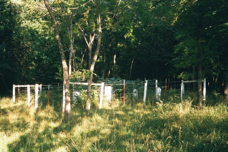
General Cemetery Info:
Dimensions
|
30ft
by 30ft
|
Altitude
|
About 252
meters
|
Number of
Tombstones
|
9 tombstones
|
Tombstone
Orientation |
Engraving
faces
West
|
|
| Driving Directions: |
|
-- Enter Adam-ondi-Ahman from
St Hwy 13 (about 2 miles south of Jameson), turn
right, and follow the signs to "Spring
Hill." At Spring Hill, turn left (south) and
go 1/2 mile towards "Tower Hill" until
a bend to the right in the road. At this bend,
there is a white gate on the left side of the
road with a small, white board with a
"16" on the board. Also, there is a
large tin silo behind the gate. Park the car
outside the gate, enter making sure you secure
the gate behind you, and follow the tractor
tracks to the silo. Now you will see a field
sloping downward. You need to cross this field
about 350 paces (yards) in a southeasterly
direction and there isn't really any kind of a
path to help you out. You can orient yourself by
heading just to the left of the quarry on the
horizon. Another way to orient yourself is to
locate five trees along the timber line whose
trunks are readily seen and 2 electric poles just
to the right of these five trees. Point yourself
between the rightmost tree trunk and the electric
poles. After going downhill the 350 paces, you
will find an opening in a fence along which a
five-wire electric powerline runs. You should be
able to see the fence of Guthrie cemetery 30
paces straight ahead into the timber.
Although this is a very difficult cemetery to
locate because of the walk, it really is simple
to find using these directions. Those familiar
with GPS locators will find this a great occasion
to use it with the coordinates above. The Church
of Jesus Christ of Latter-Day Saints also has a
Church Grounds Department telephone (660)828-4325
if further assistance is needed. |
| Maintenance Info: |
|
| -- Based on an
August 2000 visit, Guthrie Cemetery could use
some more care. It is quite evident that the
cemetery was neglected in the past and
someone--presumably Elijah Gormen--has done
restoration work on the cemetery including adding
metal support brackets to the headstones.
However, waist-high weeds indicate that no one is
actively caring for the cemetery. Although the
metal support brackets hold upright headstones
that have been broken in two, they also cover
some of the information needed to do a proper
transcription. |
| |
| Transcription Info: |
Repository
|
Elijah Gormen/BSA/Tree
Climbers (1984)
-- This transcription includes seven names but
gives a cemetery plot with nine tombstones. It
also incorrectly states that the cemetery is
located in Section 30. |
DCL
|
Steven Reid (August 2000)
-- Eight names for nine tombstones in this
transcription; plus a reconciliation with the
Tree Climbers transcription. |
Transcription
& Photos
|
|