Location
Infomation:
GPS
|
39 57' 59"N
94 02' 47"W
|
Section/
Twp/Range
|
Section 33,
T60N, R28W
|
Access
Rating
|
Very Difficult
|
General Cemetery Info:
Dimensions
|
Roughly
40ft N-S
by 10ft E-W
|
Altitude
|
About 260
meters
|
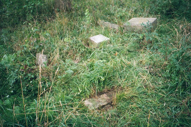
Number of
Tombstones
|
7 bases
4 tombstones
3 footstones
|
|
| Driving
Directions: |
-- From
Interstate 35 take exit 72--DD Hwy--and head east
(to your right if you are headed north on I-35)
on DD. DD will alternate east and south until
about 4 miles you come to an off-road vehicle
type dirt road (see road photo, right) on your
left called "Lilly Av." Follow Lilly
for about 1/3 mile to the top of the second hill.
Just past a group of trees on your right (south)
there is a gate in a fence (see gate photo,
right). If you haven't already parked down by the
junction of DD and Lilly, you will definitely
have to park here. Passing through the gate, the
cemetery lies 100 yards straight ahead, slightly
uphill to a grove of trees and tree stumps. The
cemetery is about 5 yards west (to the right) of
the tree stumps.
|

Road photo

Gate photo
|
| Maintenance
Info: |
| -- Based on an
August 2000 visit, Trotter Cemetery has been
totally neglected. All tombstones have been
knocked over, some buried, others appear to be
missing. Although a significant search has been
made for tombstones, someone needs to carefully
re-search for more stones, possibly buried. A
fence is needed to keep cattle and horses
out--who probably are the culprits for the
dislodged stones. After fencing it needs to be
restored and a sign made for the cemetery.
Trotter also needs summer care to keep the weeds
down. |

Needs Help!
|
| |
| Transcription Info: |
Repository
|
Gallatin
Chapter of the Daughters of the American
Revolution (1973)
-- The DAR transcription included two TROTTER
surnames as a Crab Orchard cemetery addendum but
noted that it is its own private cemetery located
1 mile south of Crab Orchard (in what would be
Liberty Twp) on route DD. Trotter cemetery
actually lies in Marion Twp, about 1 mile northwest
of Crab Orchard cemetery. |
SHS
DARL
|
Steven Reid
(August 2000)
-- Four tombstones in this transcription; the
DAR's two plus two more. |
Transcription
& Photos
|
|
Sources & Maps:
(1) BLM
records a William T. TROTTER with land patents in 1848 in
Sections 25 & 26 of T60N, R29W--about 3 miles west of
Trotter Cemetery.
(2) On page 50 of Mary Inglis' Daviess County,
Missouri, 1860 Census, a Jonathan and Nancy TROTTER
family is listed in Jefferson Twp (being as there was no
Marion Twp in 1860.)
(3) The 1876 Plat book gives the landowner of the acreage
patented by William in 1848 as owned now by "M.
Trotter." There is a Mark Trotter buried in Trotter
Cemetery. Additionally, landowners J.M. Trotter and Nancy
Trotter are shown with acreage in section 33--the same
section as Trotter Cemetery.
(4) The no name cemetery in section 34 on Jess Perry land
(1916) referred to by Elizabeth Jeffries on page 155 of History
of Daviess County (1984) is presumed to be Trotter
cemetery.
(5) Tiger
Map plots a green dot, typically
indicative of a cemetery. I have added the red stickpin.
(6) TerraServer plots and
names the cemetery.
|