Map showing the route taken
by Deane and Kavanagh to get to the Madawaska Settlement on the
Upper St.John River
The blue line shows the route Deane and Kavanagh followed from the upper Kennebec River to the confluence of the St. Francis and Upper St.John Rivers. Their Survey of the Madawaska Settlement begins at that point, and covers settlements along the St.John from the St.Francis river to the point, below Van Buren, where the straight line crosses the St.John.
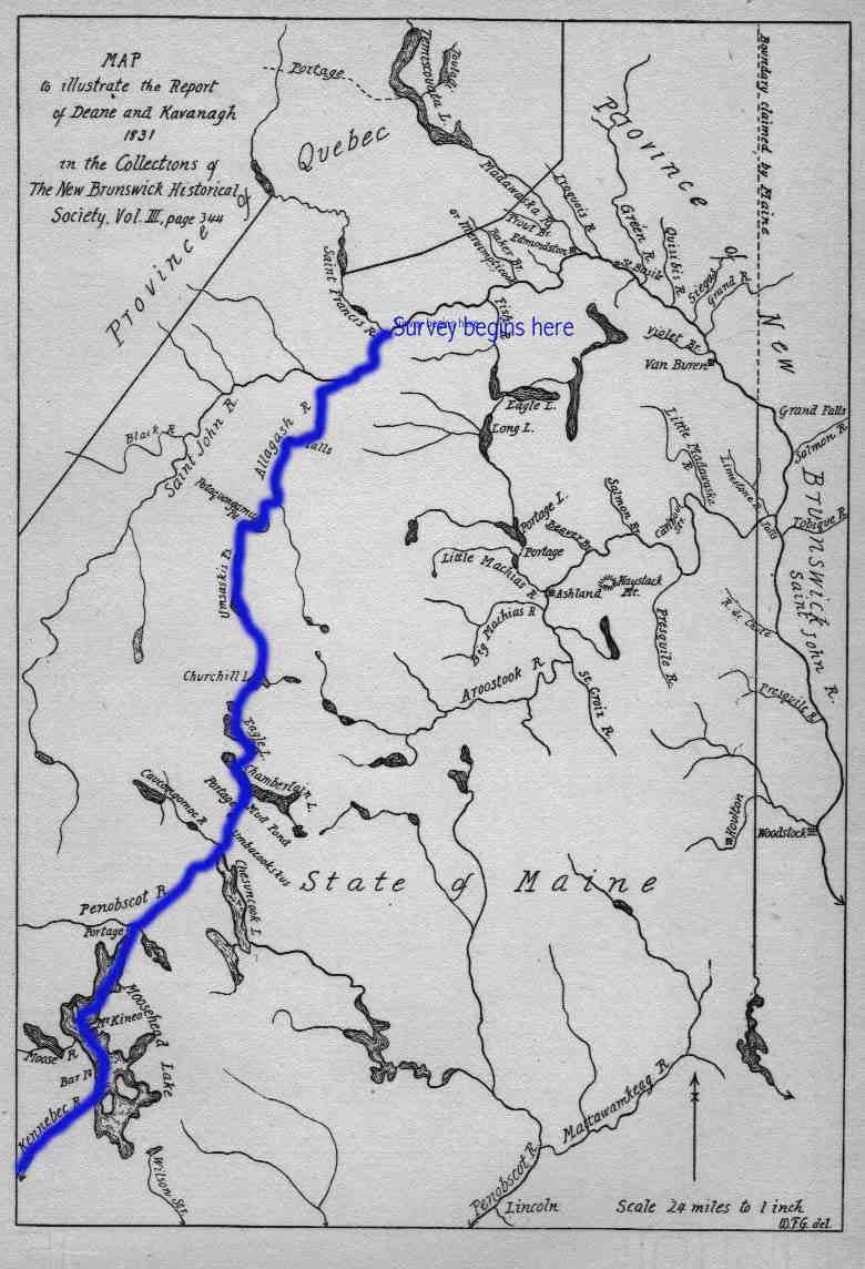
Source: "Map to illustrate the Report
of Deane and Kavanagh 1831" Raymond,
p.389.
Return to the Deane and Kavanagh Survey main page
Last revised 17 Feb 2002