

![]()
![]()
Go To Bottom of Page
General Maps
Historical Maps
County Maps
Outline Maps
![]()
General Maps
Go To Top Of Page
The maps on the left are large and detailed, while those on the right provide a state-wide view of the same map.
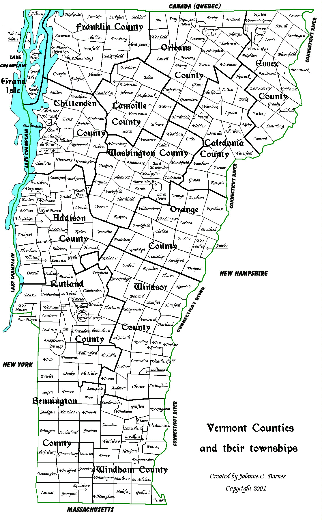
Map of Vermont Counties & Townships (w/county names) small map w/county names
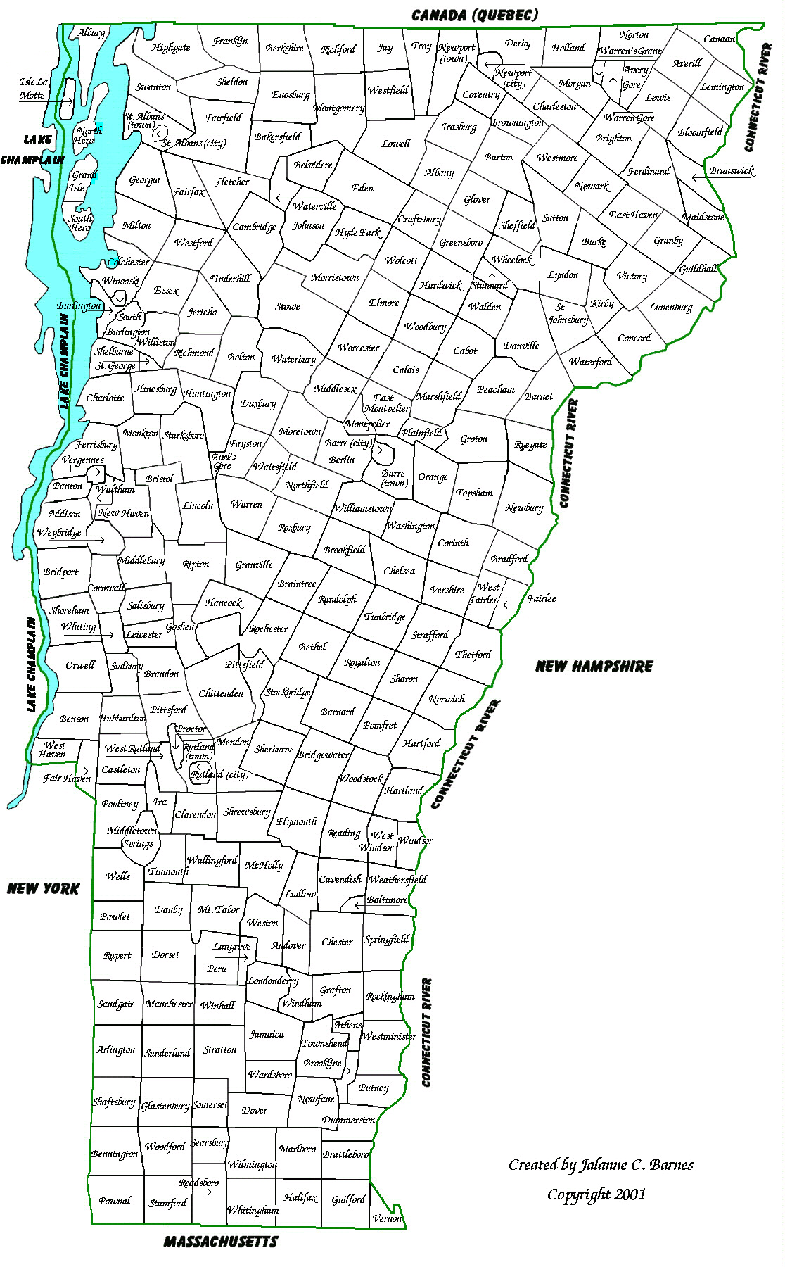
Map of Vermont Counties & Townships (w/o county names) small map w/o county names
Map of Vermont Towns with Year of Grants small map of Towns w/grant dates
![]()
Historical Maps
Go To Top Of Page
The maps on the left are large and detailed, while those on the right provide a state-wide view of the same map.
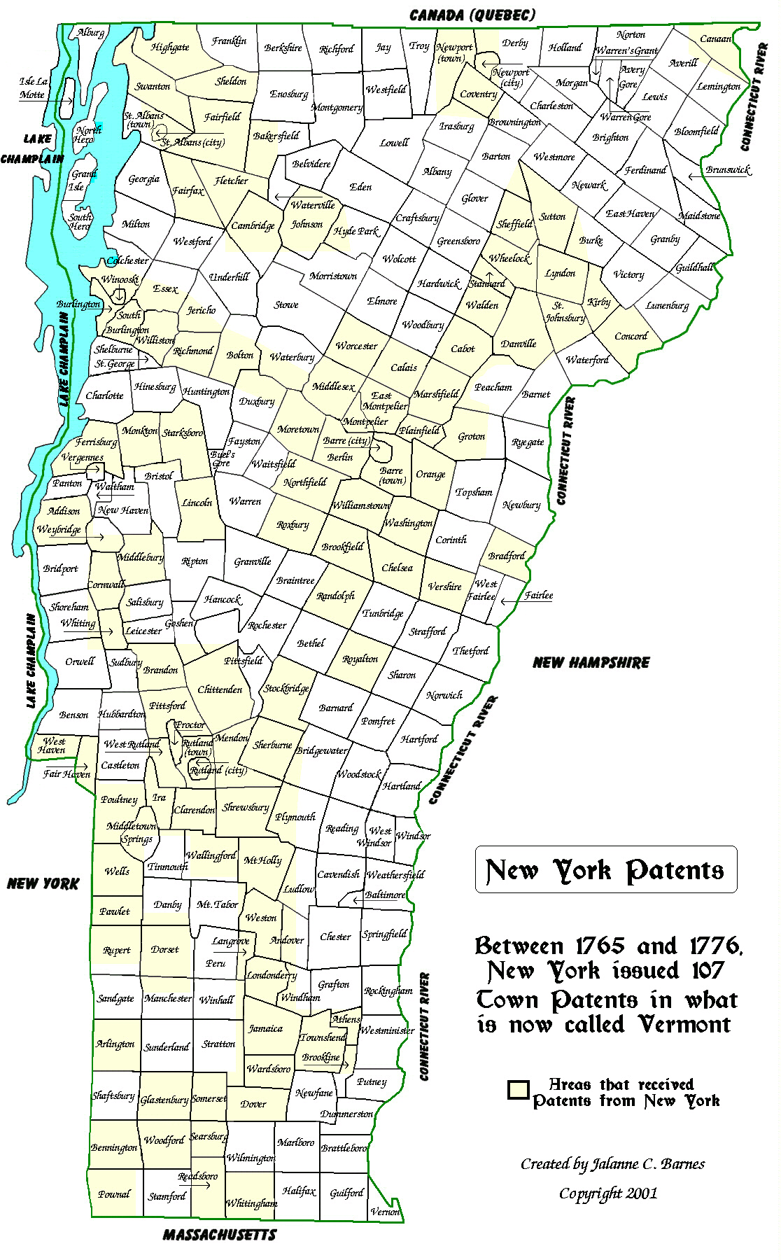
Map of New York Patents. small map of New York Patents
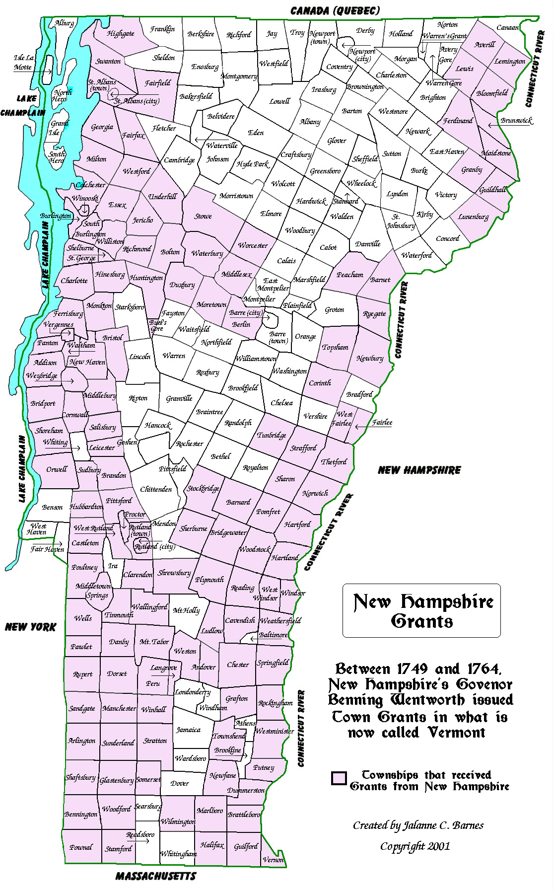
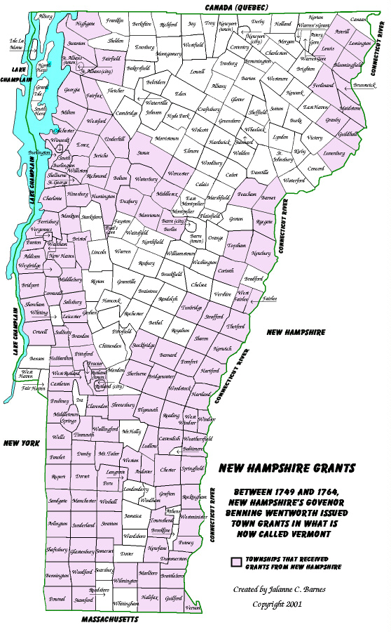
Map of New Hampshire Grants. small map of New Hampshire Grants
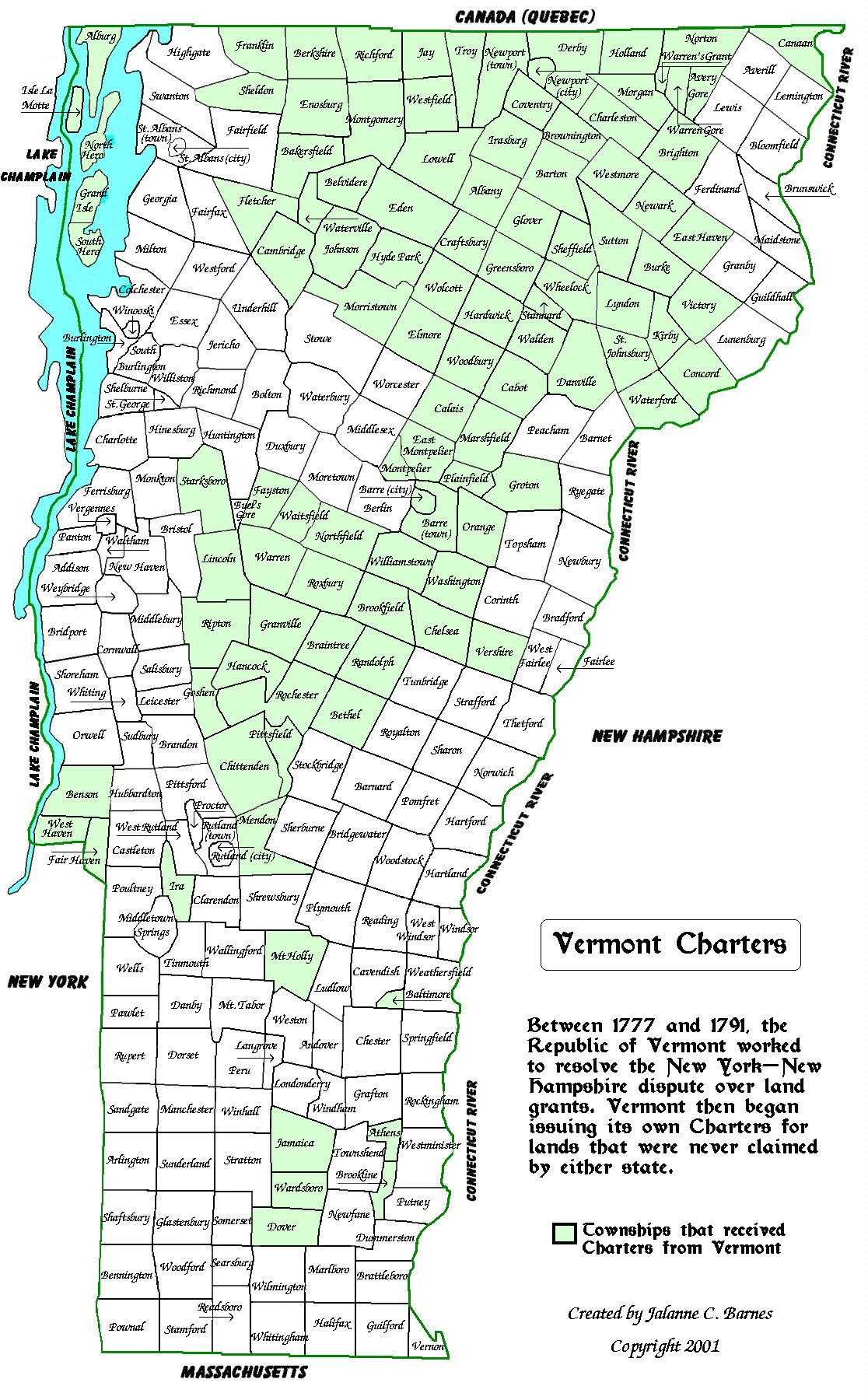
Map of Vermont Charters. small map of Vermont Charters
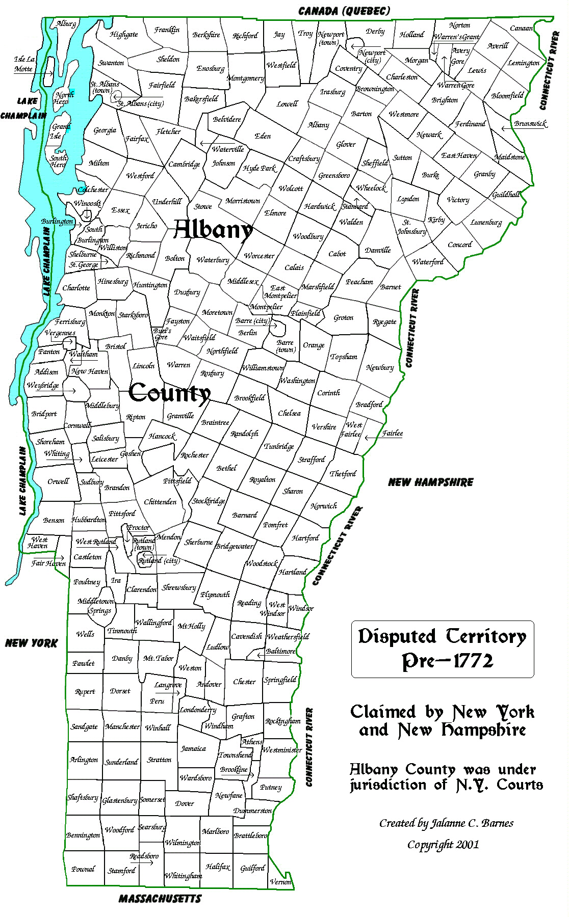
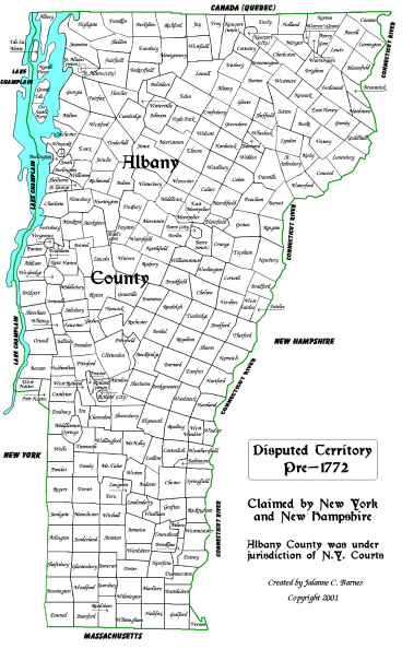
Pre-1772 map of Vermont.
small pre-1772 map
Vermont is disputed territory that is claimed by NY and NH. NY's court
system claims Vermont is Albany County, New York.
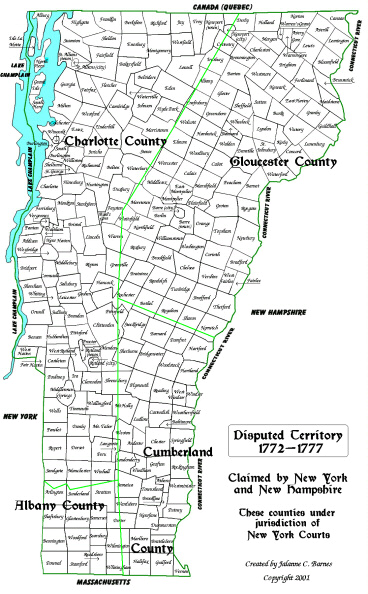
1772-1777 map of Vermont.
small
1772 map
Vermont continues to be a disputed territory belonging to NY and NH.
Vermont is now four counties: Albany, Charlotte,
Cumberland and Gloucester, which are still claimed by New York.
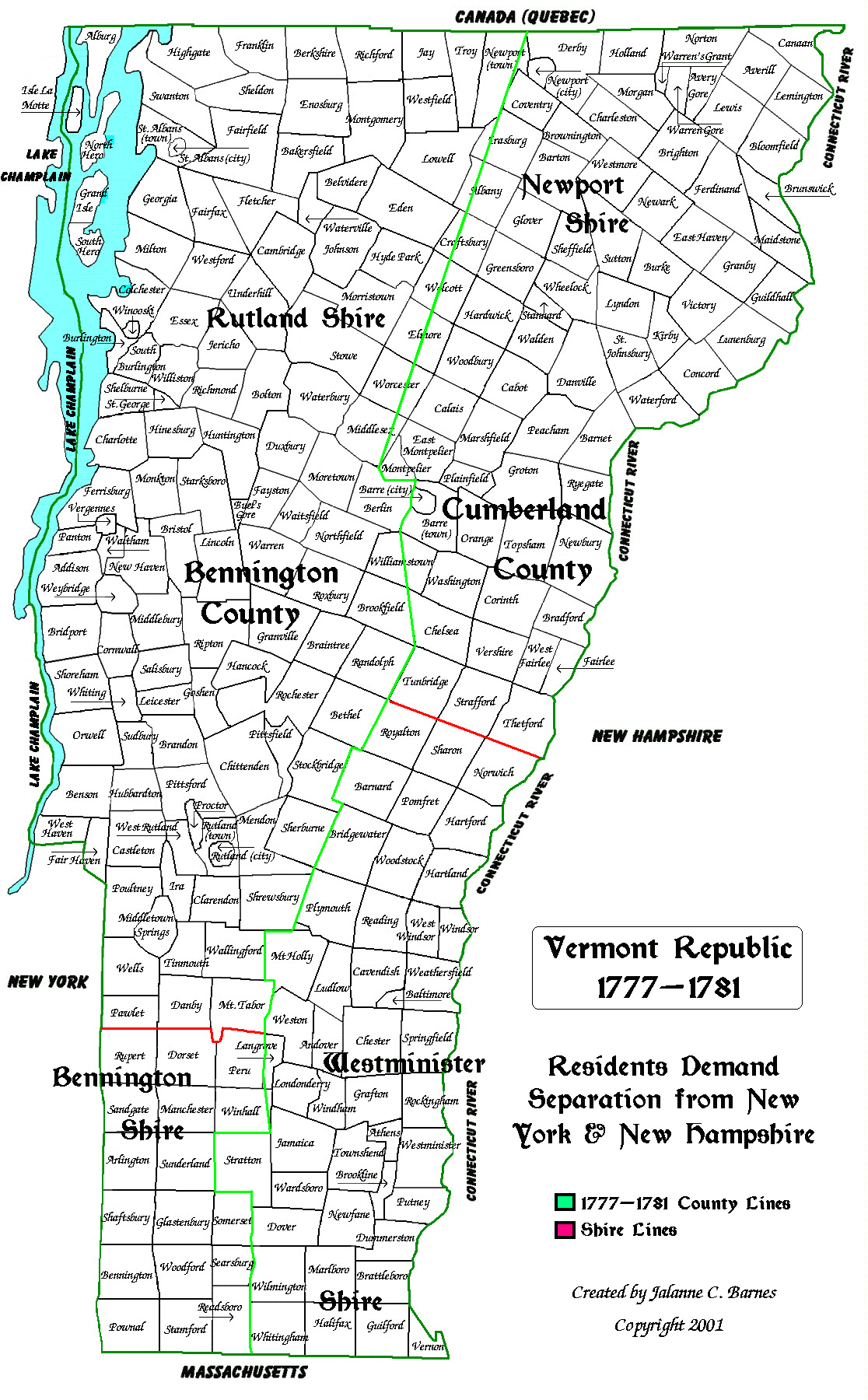
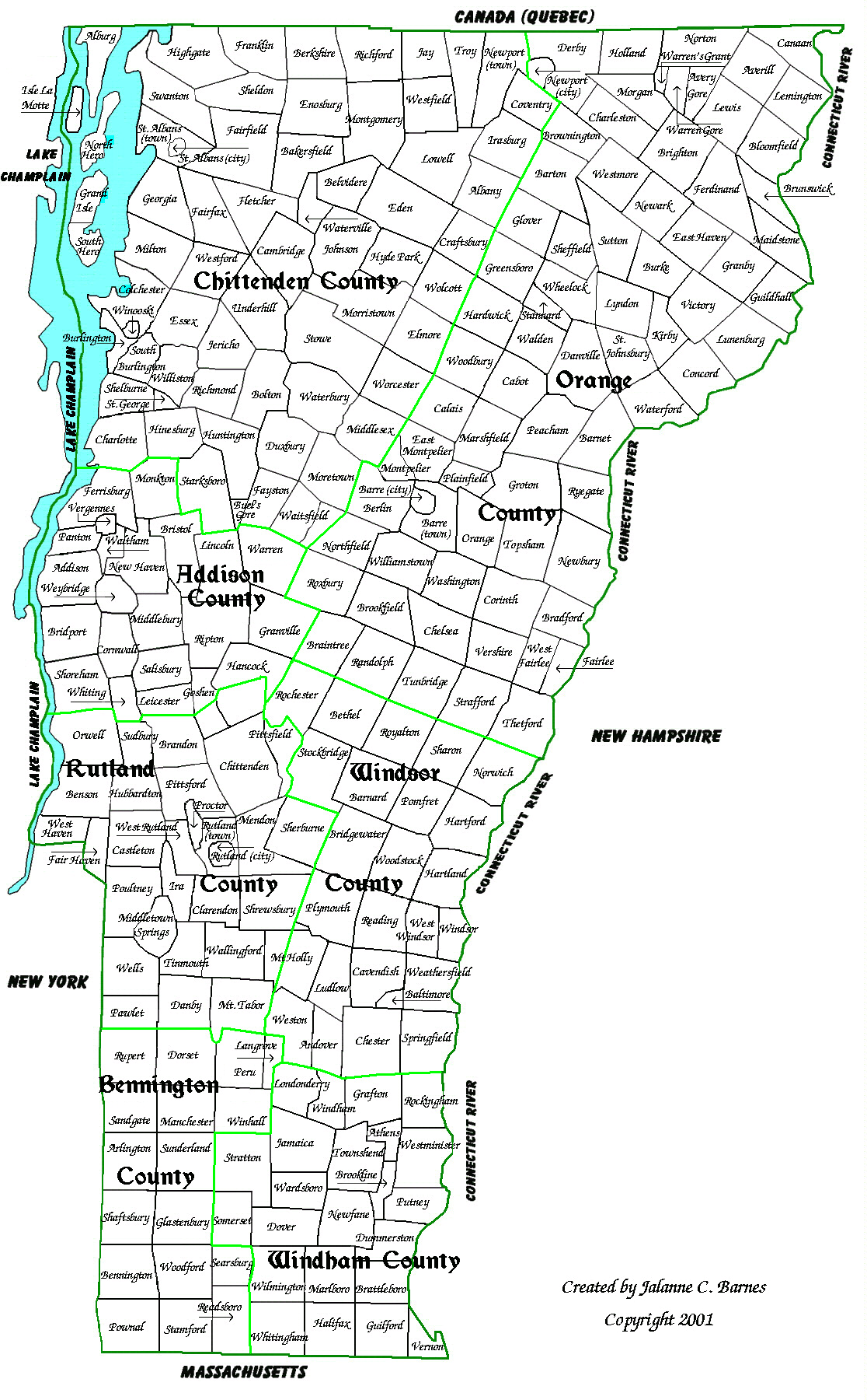
1777-1781 map of Vermont.
small
1777 map
The Republic of Vermont. The residents demand separation from NY and
NH. Vermont now consists of two counties:
Bennington County (Bennington Shire in the south, Rutland Shire in
the north) and Cumberland County (Westminister
Shire in the south, Newport Shire in the north).
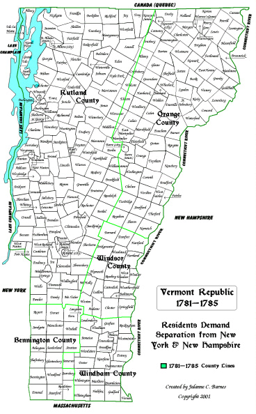
1781-1785 map of Vermont.
small
1781 map
The Republic of Vermont. Vermont now has five counties: Bennington,
Orange, Rutland, Windham and Windsor.
1785-1791 map of Vermont.
small
1785 map
The Republic of Vermont. Addison County is formed. Vermont now
had six counties: Addison, Bennington, Orange,
Rutland, Windham and Windsor.
1791-1796 map of Vermont.
small
1791 map
The State of Vermont. Chittenden County is formed. Vermont now has
seven counties: Addison, Bennington, Chittenden,
Orange, Rutland, Windham and Windsor.
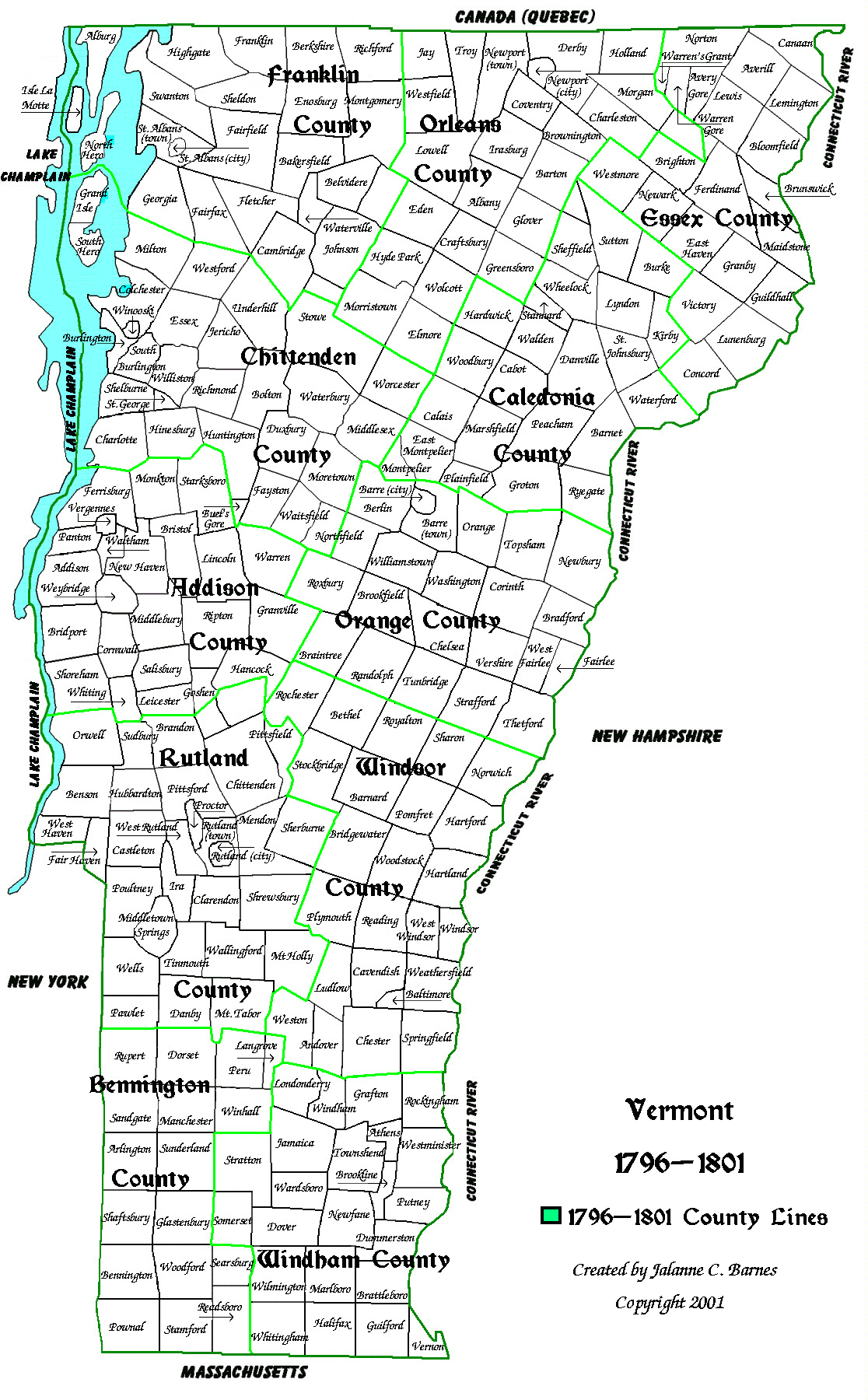
1796-1801 map of Vermont.
small
1796 map
The State of Vermont. Caledonia, Essex, Franklin and Orleans Counties
are formed.Vermont now has eleven counties:
Addison, Bennington, Caledonia, Chittenden, Essex, Franklin, Orange,
Orleans,
Rutland, Windham and Windsor.
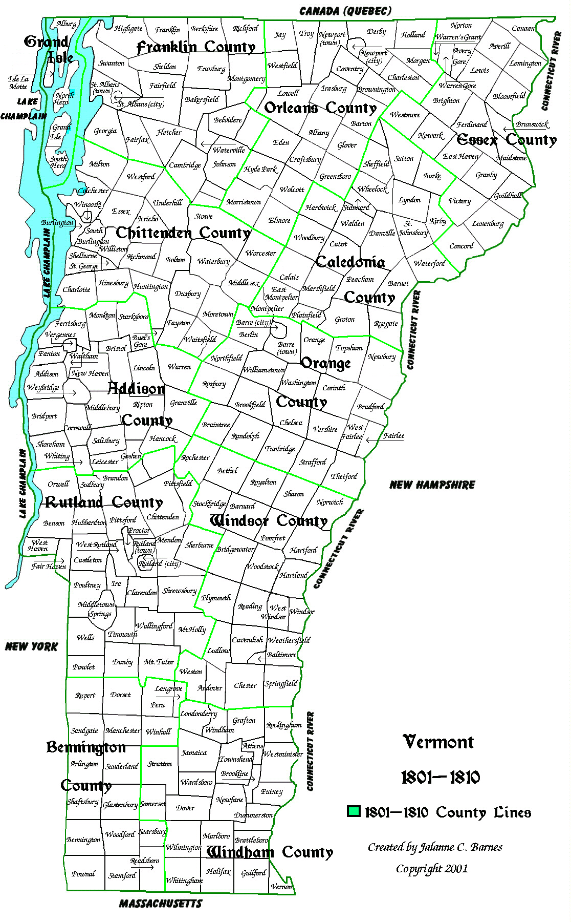
1801-1810 map of Vermont.
small 1801 map
The State of Vermont. Grand Isle County is formed. Vermont now has
twelve counties: Addison, Bennington, Caledonia,
Chittenden, Essex, Franklin, Grand Isle, Orange, Orleans, Rutland,
Windham and Windsor.
1810-1814 map of Vermont.
small
1810 map
The State of Vermont. Jefferson County is formed. Vermont now has thirteen
counties: Addison, Bennington, Caledonia,
Chittenden, Essex, Franklin, Grand Isle, Jefferson, Orange, Orleans,
Rutland, Windham and Windsor.
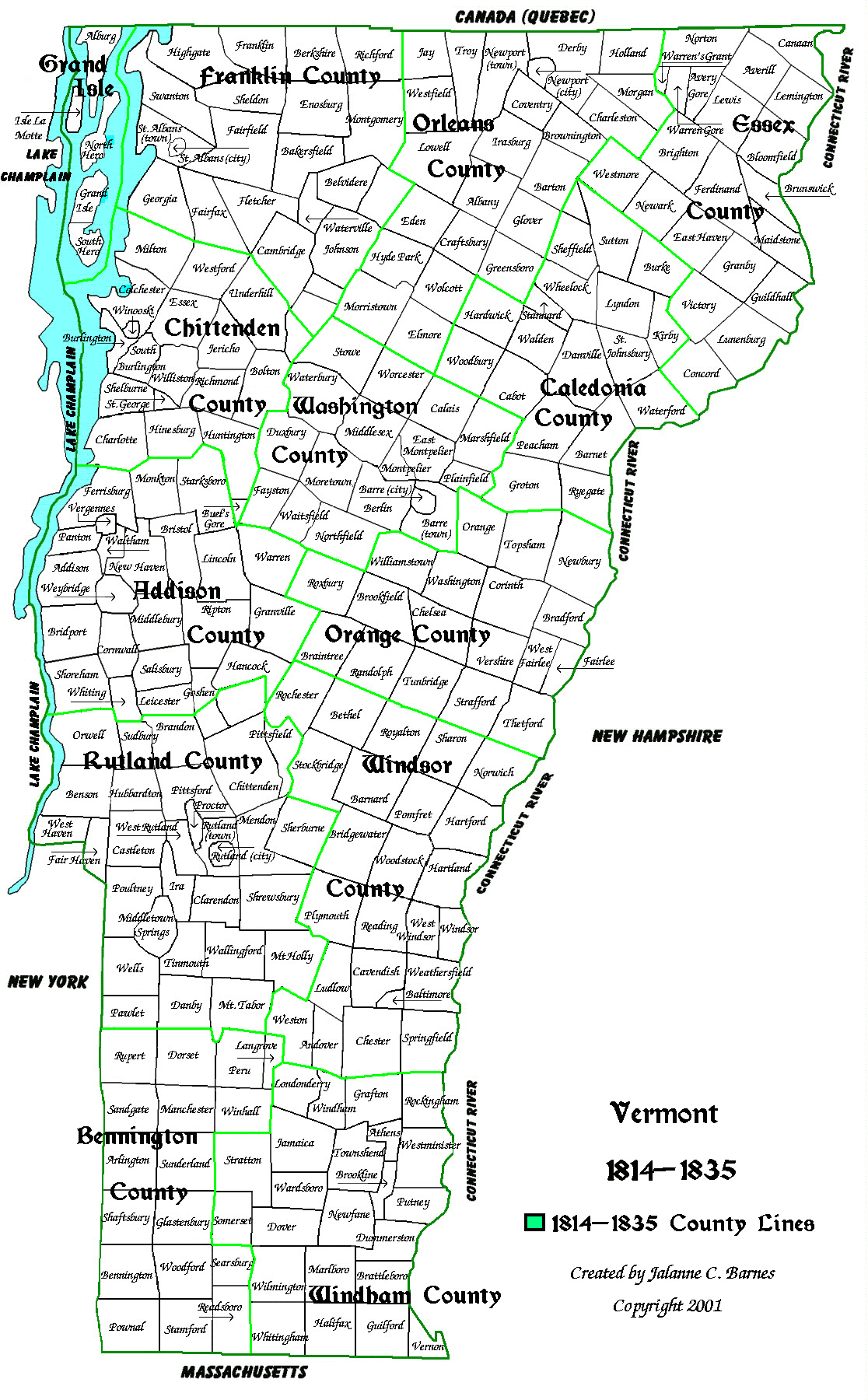
1814-1835 map of Vermont.
small
1814 map
The State of Vermont. Jefferson becomes Washington County. Vermont
still has thirteen counties: Addison, Bennington,
Caledonia, Chittenden, Essex, Franklin, Grand Isle, Orange, Orleans,
Rutland, Washington, Windham and Windsor.
1835-1890 map of Vermont.
small 1835 map
The State of Vermont. Lamoille County is formed. Vermont now
has fourteen counties: Addison, Bennington, Caledonia,
Chittenden, Essex, Franklin, Grand Isle, Lamoille, Orange, Orleans,
Rutland, Washington, Windham and Windsor.
1890-Present map of Vermont.
small 1890 map
The State of Vermont. Slight changes in county lines. Vermont still
has fourteen counties: Addison, Bennington, Caledonia,
Chittenden, Essex, Franklin, Grand Isle, Lamoille, Orange, Orleans,
Rutland, Washington, Windham and Windsor.
![]()
County Maps
Go To Top Of Page