|
|
|
|
|
|
|
|
|
|
|
|
|
|
|
|
|
|
|
|
|
|
|
|
|
|
|
|
![]()
British Colonies 1663-1775
Colonial North America 1689-1783
Eastern & Central America 1755
Eastern & Central America 1763
North America 1794
North America 1845
Boundary Changes of the United States 1650-1907 (animated map)
Maps of Areas Where US Federal Census was TakenThe Thirteen Colonies 1775
Gardener's United States 1783
United States at Peace of 1783
United States 1800
Gardiner's United States 1800
United States 1803
Western Expansion 1803-1807
Western Expansion 1815-1845
United States Territory Aquisitions
Spanish PossessionsEarly Eastern Indian Tribes
Early Western Indian Tribes
Native Lands 1816-1905
Indian Nations in the West 1899
Capt. John Smith's New England 1614
New England 1677
John Swift's New England and New York 1761
Northwest Territory 1787 (Minnesota-Ohio area)
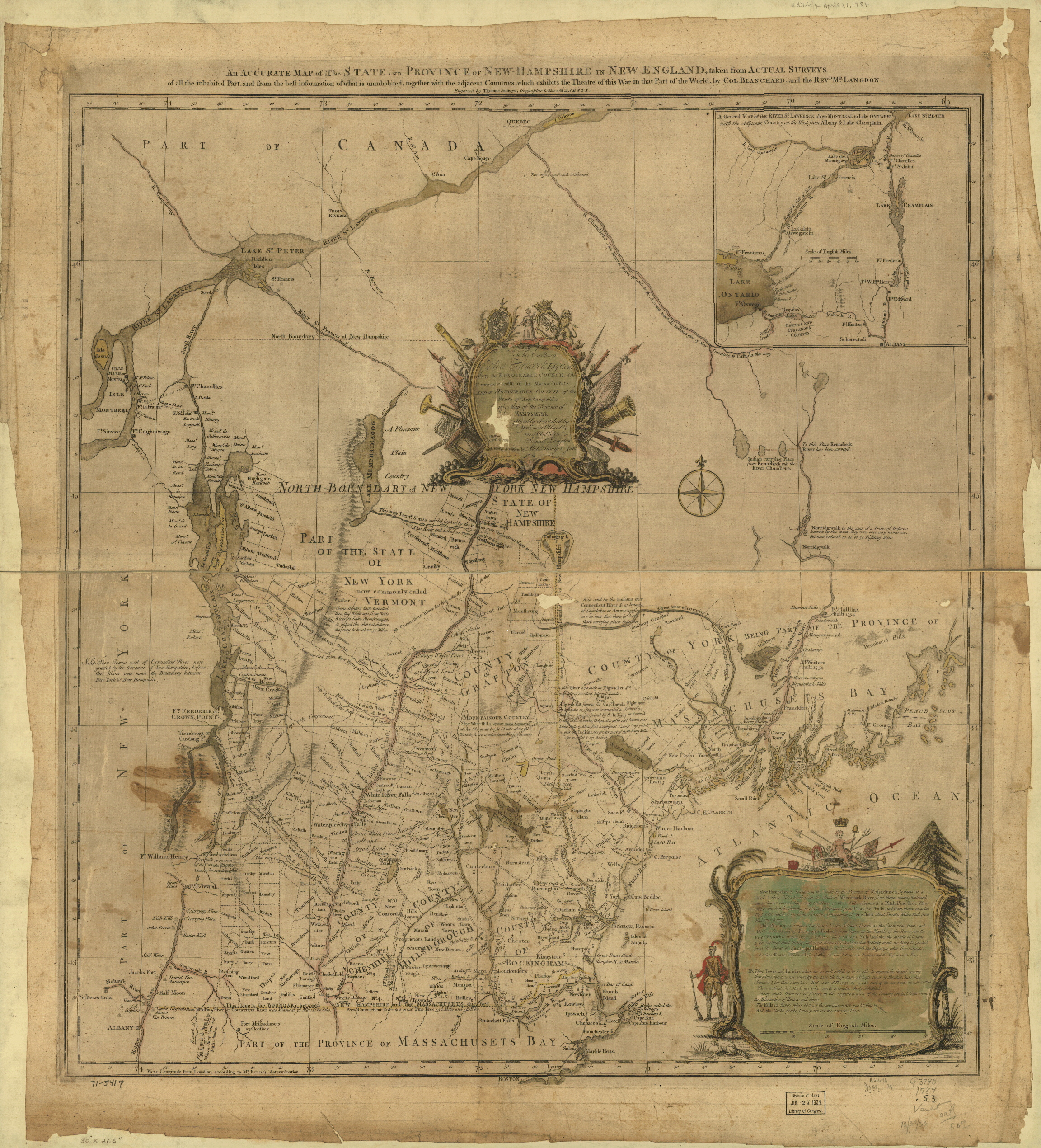
Lake Champlain 1844New Hampshire with parts of Vermont, Maine and Lower Canada 1784
Locations of New England towns where Peavey families have been found
(This is a very rough map which is not particularly accurate geographically, but it gives a very good idea where these places are located in relation to each other. Map drawn by June Peavey.)
Maine 1860
Maine 1895
Maine 1990
Outline Map of Maine CountiesMap of towns in which Peavey families lived at the time of the 1850 census (Map drawn by June Peavey)
Massachusetts 1895
New Hampshire and Vermont 1860
Durham-Newmarket area, New Hampshire, 1784
Lake Winepasaukee area, New Hampshire 1784
Lake Winepasaukee area, New Hampshire 1894
Atlantic Area of New Hampshire (Hampton-Kingston-Merrimac area)
New Hampshire in 1990
Outline Map of New Hampshire CountiesBelknap County, NH 1895
Carroll County, NH 1895
Cheshire County, NH 1895
Coos County, NH 1895
Grafton County, NH 1895
Hillsboro County, NH 1895
Merrimack County, NH 1895
Rockingham County, NH 1895
Strafford County, NH 1895
Sullivan County, NH 1895
New Hampshire and Vermont 1860
Vermont in 1990
Outline Map of VT Counties
MaineOxford, Cumberland County, about 1771New HampshireDover, Strafford County, 1877
Exeter, Rockingham County, 1896
Farmington, Strafford County, 18771806 map of Hampton (large sized)
Map of the homes of the original settlers of Hampton, NH
Map showing the original boundaries of Hampton and SalisburyMilton, Strafford County, 1888
Rochester, Strafford County, 1877
The Oregon Trail 1907
Sources of the Mississippi
Niagara Falls 1844New Brunswick 1873
Nova Scotia 1896Kentucky 1793 (click here for a large copy of map)
Massachusetts, Connecticut and Rhode Island 1990
Ohio (Forts and Trading Posts)
Texas in 1854
This site was created by Jalanne C. Barnes.
Owners retain copyright of their contributions.
![]()